€64,99
Disponibile (ordinabile)
L'articolo acquistato è disponibile per pronta consegna.

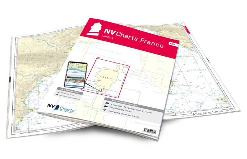
L’innovativo NV. Atlas cartaceo (35 x 45 cm) ottimizza l’ingombro della classica carta nautica con un prodotto comodo da sfogliare. Le carte nautiche sono consultabili anche mediante una App gratuita, compresa nella confezione, valida un anno dall’attivazione, facile da usare su tutti i dispositivi mobili e PC.
Description
Dreamlike and demanding: This is how the island of Corsica, which is completely covered with the Atlas FR11, presents itself. Small offshore islands and gusty winds require full concentration here. Only a few anchorages are really sheltered from the wind. Experienced water sports enthusiasts will experience unforgettable moments around Corsica. Not for nothing is the island called “Île de la Beauté”. As a mountainous Mediterranean island, Corsica offers a mixture of elegant coastal cities, pine forests and rugged mountain landscapes. Bastia, Porto Vecchio and Ajaccio are all served by large ferries and offer plenty of berths. Saint-Florent, Calvi, Propriano and Bonifacio are also equipped with many berths. So if you want to experience true Mediterranean beauty, you will not be able to avoid this island!
Thanks to the clear structure, the skipper can quickly find approaches, harbours and anchorages and is informed of important navigational details that also appear in the NV Charts app. The chart series impresses with its optimal scales and balanced sheet cuts.
This chart set contains
NV Atlas chart format
NV Charts nautical charts are available in an outstandingly practical, handy atlas booklet format and thus offer many advantages over formats from other manufacturers. The nautical chart series have been designed by nautical experts and passionate water sports enthusiasts with the needs of recreational boating in mind.
The NV Atlas has a very flat staple binding in the middle, so that the course triangle can also be used there without any problems. This innovative development makes it possible to look up charts quickly and always have them in the best possible order at the same scale. The NV Atlas is delivered in a plastic cover protected against splash water. This modern nautical chart format is very popular on sailing boats as well as on motor yachts and is the preferred choice of many of our customers.
NV Charts navigation app
All NV Charts nautical charts also include an access code to the digital nautical charts in the NV Charts app and can thus be easily downloaded. The charts are valid for 365 days from activation and can be used for offline navigation with the NV Charts app on iOS, Android, PC and Mac or also in the web browser.
The NV Charts app is the ideal addition on mobile devices. With the app, you can already plan a detailed route at home and thus prepare for your journey in the best possible way in conjunction with the paper chart. The app is intuitive to use and, thanks to an identical map image, you can orientate yourself on paper and digitally in a matter of seconds. The most up-to-date information is essential to navigate safely on the water with your sailboat or motorboat.
With the NV Charts app, you now have the opportunity to become part of the chart community. You can mark harbours, anchorages and navigation warnings on the digital nautical chart and also add interesting places beyond navigation, such as restaurants, with pictures and comments and share your experiences with other users. In addition, the NV Charts app offers an automatic routing function, search and all navigation functions for GPS navigation with your phone or tablet. More information at: nvcharts.com/app
More PC navigation apps: NV Verlag / NV Charts nautical charts can also be used in many other nv.digital compatible PC navigation programs such as NV Chart Navigator or Open CPN.
Our recommendation:
As a further recommendation on this map set we advise you to use the IT3 and IT4 to circumnavigate the neighbouring island of Sardinia. It is also possible to continue towards the French mainland (with the FR10) or Italian mainland (with the IT1). We will be happy to put together suitable cruising guides for you.
Charts and scales included
Oversailers
C 1 Alicante to Rome 1: 1750000 C 2 Corsica 1: 350000
District charts
C 3 Cap Corse to Elba 1: 150000 C 4 Cap Corse to Calvi 1: 150000 C 5 Calvi to Ajaccio 1: 150.000 C 6 Ajaccio to Pte. de Senetosa 1: 150.000 C 7 Pte. de Senetosa to Cap Pertusato 1: 150.000 C 8 Cap Pertusato to Marina du Caprone 1: 150.000 C 9 Marina du Caprone to Bastia 1: 150.000 C10 Bastia to Macinaggio 1: 60.000 C11 Macinaggio to Port de Centuri 1: 60.000 C12 Port de Centuri to Pta. di Malfalcu 1: 60000 C13 Pta. di Malfalcu to Calvi 1: 60000 C14 Calvi to Gargalu 1: 60000 C15 Gargalu to Pta. dOmigna 1: 60000 C16 Pta. dOmigna to Sanguinaires 1: 60000 C17 Sanguinaires to Cap Muro 1: 60000 C18 Cap Muro to Pte. de Senetosa 1: 60000 C19 Pte. de Senetosa to Cap de Feno 1: 60000 C20 Strait of Bonifacio 1: 60000 C21 Ile Cavallo to Porto-Vecchio 1: 60000
Details
C22 A Bastia 1: 12.000 C22 B Port de Taverna 1: 6000 C22 C Santa Severa 1: 6000 C22 D Macinaggio 1: 12000 C22 E Port de Centuri 1: 12000 C23 A Golfe de St.-.Florent 1: 12000 C23 B St. Ambrogio 1: 6000 C23C LIle Rousse 1: 12000 C24 A Golfe de Calvi 1: 12000 C24 B Ajaccio 1: 12000 C25 A Propriano 1: 12000 C25 B Porto Pollo 1: 10000 C25 C Baie de Campomoro 1: 12000 C26 A Cargèse 1: 6000 C26 B Baie de Figari 1: 12.000 C27 A Bonifacio 1: 6.000 C27 B Iles Cavallo & Lavezzi 1: 25.000 C28 A Golfe de Porto-Vecchio 1: 25.000 C28 B Golfe de Pinarellu 1: 25.000 C28 C Solenzara 1: 6.000 C29 Porto-Vecchio 1: 10.000
Légende – Legend – General Notes p.30

Via Gaetano Trezza 12
37129 Verona
T. +39 045 8012631
frangente@frangente.com

